
FELIS – Federal Lands Information System
Project Name: FELIS – Federal Lands Information System
Client: Federal Ministry of Housing, Environment & Urban Development
Country: Nigeria
FELIS goal is to record information about federal land use and ownership using nationwide remotely accessed centralized computerized system.
Data is gathered from four sources:
- Land
- Certificate of Occupancy (C of O)
- Ownership
- Secondary Transaction (Deed)
Client Needs
The Federal Ministry broad objectives were to facilitate use of land resources and achieve the following goals:
- Improve people’s quality of life
- Greater tenure security
- Increase government taxes revenue
- Increase productivity
- Better distribution of land access and ownership
- Increasing the availability, accessibility and affordability of land services
“To guarantee title and foster confident market dealings in landed properties nationwide.”
Projects Process
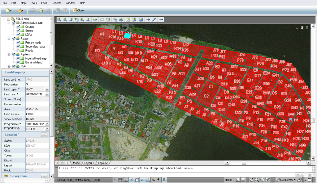
FELIS is a geospatial information system with a centralized database serving over 15 remote sites.
The project includes:
- Land records rehabilitation
- Software development and licenses
- Data conversion
- Archive computerization
- Hardware, communication, peripherals, infrastructure
- Assimilation of work processes
- Onsite training
- Routine ongoing maintenance
FELIS project focuses on Geospatial capabilities and requires deep knowledge in Land administration and GIS technology. FELIS is used by government officials and the public.
FELIS Geospatial information system implementation began on February 2005. These days the system provides information to several hundred remote users located throughout Nigeria.
Sivan Design currently develops additional phases of the system yet expanding and providing nationwide support and maintenance services.
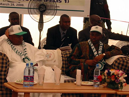
The commissioning of FELIS
Description of the services provided
FELIS is a multi-phase long termed turnkey project. It started by going over and arranging paper title files, scanning, uploading, processing and binding of relevant data, and ended by allowing every Nigerian to retrieve basic geospatial information online from FELIS website for free.
Sivan Design’s Land Information System (LIS) flexibility allowed fields and values customization according to specific client needs. The LIS is one of the core parts that accumulate the Geo-ERP™ solution.
Plots information was digitized, geo-referenced and uploaded to the system. Title records were then linked to those plots. During this time consuming process each data insertion team process was monitored by a quality assurance (QA) person that was conducting data validity and quality checks and assuring data integrity.
The next phase was to establish completely new service center and offices. The newly setting required wiring infrastructure, hardware, peripherals, software, reliable Internet connection, furnishing and accessories. All, down to printer paper, were supplied by Sivan Design to meet client’s needs.
The most comprehensive system would be useless if its users would not have the knowhow on how to benefit from it. Sivan Design, in tight collaboration with the ministry personnel, carefully studied their needs and was able to design business processes to meet land regulations.
Following system assembly, the ministry users were thoroughly trained from basic computer skills via GIS capabilities to the services and information provided specifically by FELIS system.
Sivan Design’s Land Information System (LIS) flexibility allowed fields and values customization according to specific client needs
The project included many activities and services all of which were provided by Sivan Design:
- Infrastructure of newly established service center including electricity, telephony and network wiring
- Hardware equipment including servers, desktops, scanners, printers and peripherals
- Communication equipment and configuration setup including broadband internet and Local Area Network (LAN)
- Software licenses of servers and desktop’s operation systems, GIS, CAD, imaging etc.
- Rehabilitation of existing land information records and files
- Data acquisition and conversion of titles, cadastre maps etc.
- Digitization of archives
- GIS implementation of all relevant layers
- Deployment in over 15 remote sites
- Training and support of relevant personnel
- Maintenance routine and ongoing support
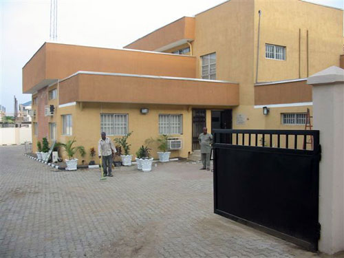
FELIS main office building
Results
Click to Enlarge >
Today land officers from various remote sites use and update the system with both alphanumeric and spatial data on a daily basis. These land officers were all trained by Sivan Design and now have the knowhow to independently operate the system. Training process began with basic computer skills to expert spatial;editing functions.
The system was developed and deployed by Sivan Design using the most advanced technologies and infrastructures.
Software: Microsoft .Net, Autodesk GIS software, Microsoft SQL database, multi-tier architecture, etc.
Hardware and peripherals: HP workstations, HP servers, plotter, Internet connection
Accessories: air-conditioning, generator, office equipment and many more
Sivan Design was and still is responsible for all project aspects and is proud of the top quality of this project. FELIS quality is based on deep – professional knowledge, advanced technology, and also on effective infrastructure and highly trained team that is operating the system daily.
FELIS in the News
GIS Development > The Global Geospatial Magazine – May 2010
|

allafrica.com > FG to Draft National Land Policy – July 2009FG to Draft National Land Policy |
 – I am quite delighted to note that the programme which saw the establishment of the Federal Land Information System (FELIS) has been quite successful. Service Centres for FELIS have been established in many of our Field Offices in the States preparatory…
Daily Trust > FELIS has efficient database – June 2009
|