
EGIS – Electric Network Geographic Information System

Based on GeoERP technology, EGIS (Electric Network GIS) provides utility companies with a comprehensive status reports and inventory of the electrical distribution network components and their spatial locations. GIS plays a strong role in managing electric power transmission and distribution of both traditional and smart grid networks. Managing data using GIS becomes essential when smart grid is applied over the electric network.
EGIS includes data-driven assets and resources management tools that allow the enterprise to create and author spatial information about utility assets such as poles, wires, transformers, duct banks, or even customers. When information from outside the utility, such as traffic or weather systems, is added to information supplied by ENGIS, decision-makers are provided with the most current and all-inclusive network status report. The combined information is used by utilities for various business need from visualizing current operating status via inspection and maintenance procedures to future planning and network analysis.
Mobile devices and field crews
EGIS includes mobile and remote functionality that provides the utility company with the ability to collect information about its assets from on-site or field crews. The collection of assets condition data is essential for utilities and is nearly impossible to perform without a reliable GIS based system. Information about assets’ condition is collected from either automated systems or from dedicated inspection systems. Nowadays utilities are rapidly adopting and rely on the use of GIS-based mobile devices for inspection and maintenance purposes. EGIS is fully compatible with information gathered from these mobile devices and any abnormal activity can be automatically highlighted and visualized.
Network Connectivity Planning
EGIS provides the tools for network modeling and advanced workflows outlining. This is essential in cases where networks are based on, or planning to convert to, smart grid. The complexities of smart grid networks that include two different networks – electric and communications – require extensive understanding of the physical and spatial relationships among all network devices. These relations reflect to the connectivity conditions and availability between both networks and become the core elements used in the decision-making process of modeling a smart gird network.
Understanding the surrounding environment of networks assets adds another advantage to the utility company. This knowledge is also essential for security purposes, storm tracking and restoration following an impact.
Network State Awareness
EGIS provides the utility company with the ability to monitor smart grid networks and perform queries concerning the network health. The system can display the complete network and highlight assets that have changed or that are malfunctioned. When projecting this feature upon the whole network it becomes clear that EGIS can show the entire state of the grid in an easy-to-understand realistic model.
EGIS is a complementary partner when transitioning to smart grid networks that can contribute in the conversion of the grid from a passive system to an intelligent interactive one. Utilities can monitor the construction progress, efficiently route crews and most importantly, provide the best analysis for the optimum location for repeaters, sensors, and new communication backbones.
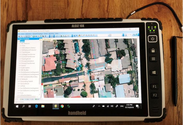
Mobile device for collecting data from the field regarding the status of the existing electricity grid